 Cooch Behar State (Princely State): All Data
This page is about the data available for this polity; the chronology of its events is available here.
Was a princely state in India during the British Raj. The state was placed under the Bengal States Agency, part of the Eastern States Agency of the Bengal Presidency. It is located south of the Himalayan kingdom of Bhutan, in present-day West Bengal.
1. Genealogy

2. Maps of Political Control Over Time
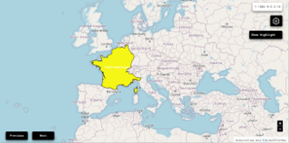
 Cooch Behar State (Princely State) : Map showing the initial year each territory was ruled by the polity
Cooch Behar State (Princely State) : Maximal Extension of the Polity
Cooch Behar State (Princely State) : Map showing the initial year each territory was ruled by the polity
Cooch Behar State (Princely State) : Maximal Extension of the Polity
3. Monthly Summaries

4. Lists and Timelines
5. Rankings
 Cooch Behar State (Princely State) : Top wars ordered by largest reached area
Cooch Behar State (Princely State) : Top wars by territorial gain or loss in terms of area of the changes
Cooch Behar State (Princely State) : Top wars by territorial gain or loss in terms of area difference
Cooch Behar State (Princely State) : Top wars ordered by largest reached area
Cooch Behar State (Princely State) : Top wars by territorial gain or loss in terms of area of the changes
Cooch Behar State (Princely State) : Top wars by territorial gain or loss in terms of area difference
6. Time Series
Cooch Behar State (Princely State) : Time Series of all Territorial Changes
Cooch Behar State (Princely State) : time series of its population and area throughout history

