 Federation of Bosnia and Herzegovina: All Data
This page is about the data available for this polity; the chronology of its events is available here.
A country in Southeastern Europe, located in the Balkans. Bosnia and Herzegovina borders Serbia to the east, Montenegro to the southeast, and Croatia to the north and southwest.
1. Genealogy
2. Maps of Political Control Over Time
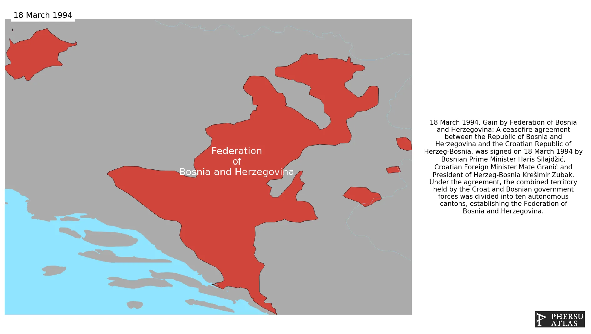
 Federation of Bosnia and Herzegovina : Map showing the initial year each territory was ruled by the polity
Federation of Bosnia and Herzegovina : Map depicting the polity's ruler in power when each territory was first controlled
Federation of Bosnia and Herzegovina : Maximal Extension of the Polity
Federation of Bosnia and Herzegovina : Map showing the initial year each territory was ruled by the polity
Federation of Bosnia and Herzegovina : Map depicting the polity's ruler in power when each territory was first controlled
Federation of Bosnia and Herzegovina : Maximal Extension of the Polity
3. Monthly Summaries

4. Lists and Timelines
 Federation of Bosnia and Herzegovina : List of events the polity was involved in
Federation of Bosnia and Herzegovina : List of Rulers
Federation of Bosnia and Herzegovina : Timeline of Rulers
Federation of Bosnia and Herzegovina : List of events the polity was involved in
Federation of Bosnia and Herzegovina : List of Rulers
Federation of Bosnia and Herzegovina : Timeline of Rulers
5. Rankings
 Federation of Bosnia and Herzegovina : Top rulers ordered by largest reached area
Federation of Bosnia and Herzegovina : Top wars ordered by largest reached area
Federation of Bosnia and Herzegovina : Top rulers by territorial gain or loss in terms of area difference
Federation of Bosnia and Herzegovina : Top wars by territorial gain or loss in terms of area of the changes
Federation of Bosnia and Herzegovina : Top wars by territorial gain or loss in terms of area difference
Federation of Bosnia and Herzegovina : Top rulers ordered by largest reached area
Federation of Bosnia and Herzegovina : Top wars ordered by largest reached area
Federation of Bosnia and Herzegovina : Top rulers by territorial gain or loss in terms of area difference
Federation of Bosnia and Herzegovina : Top wars by territorial gain or loss in terms of area of the changes
Federation of Bosnia and Herzegovina : Top wars by territorial gain or loss in terms of area difference
6. Time Series
Federation of Bosnia and Herzegovina : Time Series of all Territorial Changes
Federation of Bosnia and Herzegovina : time series of its population and area throughout history

