 Hydebarad State: All Data
This page is about the data available for this polity; the chronology of its events is available here.
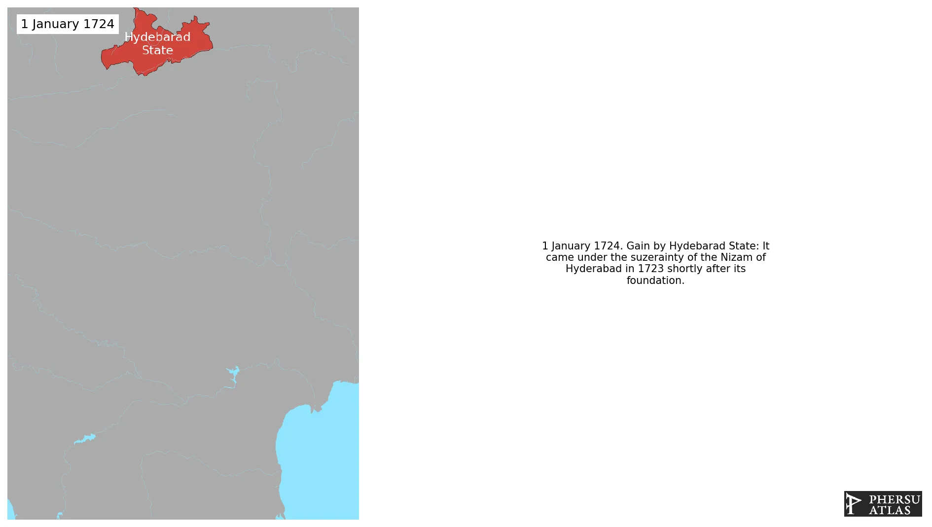
Was a Indian polity located in the south-central Deccan region of India with its capital at the city of Hyderabad. It is now divided into the present-day state of Telangana, the Kalyana-Karnataka region of Karnataka, and the Marathwada region of Maharashtra in India. The state was ruled from 1724 to 1857 by the Nizam, who was initially a viceroy of the Mughal empire in the Deccan. Hyderabad gradually became the first princely state to come under British paramountcy signing a subsidiary alliance agreement.
1. Genealogy

2. Maps of Political Control Over Time
 Hydebarad State : Map showing the initial year each territory was ruled by the polity
Hydebarad State : Maximal Extension of the Polity
Hydebarad State : Map showing the initial year each territory was ruled by the polity
Hydebarad State : Maximal Extension of the Polity
3. Monthly Summaries

4. Lists and Timelines
5. Rankings
 Hydebarad State : Top wars ordered by largest reached area
Hydebarad State : Top wars by territorial gain or loss in terms of area of the changes
Hydebarad State : Top wars by territorial gain or loss in terms of area difference
Hydebarad State : Top wars ordered by largest reached area
Hydebarad State : Top wars by territorial gain or loss in terms of area of the changes
Hydebarad State : Top wars by territorial gain or loss in terms of area difference
6. Time Series
Hydebarad State : Time Series of all Territorial Changes
Hydebarad State : time series of its population and area throughout history
7. All Events mentioned in Territorial Changes
 Conquests of Shahu I
Anglo-Mysore Wars
Second Anglo-Mysore War
Third Anglo-Mysore War
Conquests of Shahu II
Partition of India
Operation Polo
Conquests of Shahu I
Anglo-Mysore Wars
Second Anglo-Mysore War
Third Anglo-Mysore War
Conquests of Shahu II
Partition of India
Operation Polo
8. All Cities mentioned in Territorial Changes
 Bidar
Chytal
Hingoli
Guntur
Akola
Aurangabad (Maharashtra)
Bellary
Bidar
Chandrapur
Gulbarga
Hindupur
Hospet
Hyderabad (India)
Karimnagar
Khammam
Kurnool
Latur
Nanded
Nandyal
Nizamabad
Parbhani
Proddatur
Raichur
Solapur
Warangal
Latur
Mominabad (neighbourhood)
Surriapet
Narkatpalli
Guntur
Akola
Bellary
Chandrapur
Gulbarga
Hindupur
Hospet
Karimnagar
Khammam
Kurnool
Nandyal
Nizamabad
Parbhani
Proddatur
Raichur
Solapur
Warangal
Bidar
Hyderabad (India)
Guntur
Rajeshwar
Osmanabad
Aurangabad (Maharashtra)
Jalna
Bidar
Chytal
Hingoli
Guntur
Akola
Aurangabad (Maharashtra)
Bellary
Bidar
Chandrapur
Gulbarga
Hindupur
Hospet
Hyderabad (India)
Karimnagar
Khammam
Kurnool
Latur
Nanded
Nandyal
Nizamabad
Parbhani
Proddatur
Raichur
Solapur
Warangal
Latur
Mominabad (neighbourhood)
Surriapet
Narkatpalli
Guntur
Akola
Bellary
Chandrapur
Gulbarga
Hindupur
Hospet
Karimnagar
Khammam
Kurnool
Nandyal
Nizamabad
Parbhani
Proddatur
Raichur
Solapur
Warangal
Bidar
Hyderabad (India)
Guntur
Rajeshwar
Osmanabad
Aurangabad (Maharashtra)
Jalna