 Flandern County: All Data
This page is about the data available for this polity; the chronology of its events is available here.
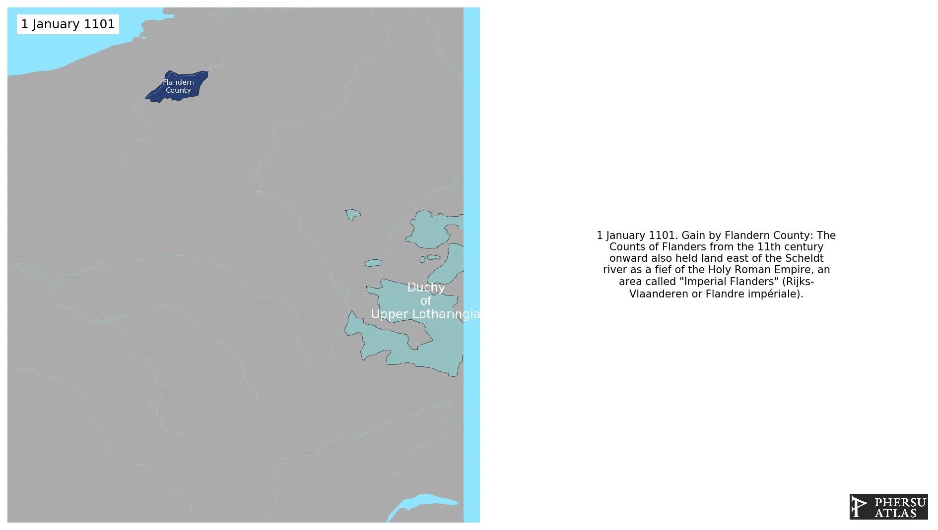
Was a historic territory in the Low Countries.Up to 1477, the area under French suzerainty was west of the Scheldt and was called "Royal Flanders". the counts, from the 11th century onward, held land east of the river as a fief of the Holy Roman Empire: "Imperial Flanders". It later became part of the Burgundy-Valois Domains.
1. Genealogy

2. Maps of Political Control Over Time
 Flandern County : Map showing the initial year each territory was ruled by the polity
Flandern County : Maximal Extension of the Polity
Flandern County : Map showing the initial year each territory was ruled by the polity
Flandern County : Maximal Extension of the Polity
3. Monthly Summaries

4. Lists and Timelines
5. Rankings
 Flandern County : Top wars ordered by largest reached area
Flandern County : Top wars by territorial gain or loss in terms of area of the changes
Flandern County : Top wars by territorial gain or loss in terms of area difference
Flandern County : Top wars ordered by largest reached area
Flandern County : Top wars by territorial gain or loss in terms of area of the changes
Flandern County : Top wars by territorial gain or loss in terms of area difference
6. Time Series
Flandern County : Time Series of all Territorial Changes
Flandern County : time series of its population and area throughout history
7. All Events mentioned in Territorial Changes
 Anglo-French War of 1294-1303
English expedition to Flanders (1297-98)
Franco-Flemish War
Invasion of Hainaut and Zeeland
Hundred Years' War
Edwardian War
Anglo-French War of 1294-1303
English expedition to Flanders (1297-98)
Franco-Flemish War
Invasion of Hainaut and Zeeland
Hundred Years' War
Edwardian War
