 Luxembourg County: All Data
This page is about the data available for this polity; the chronology of its events is available here.
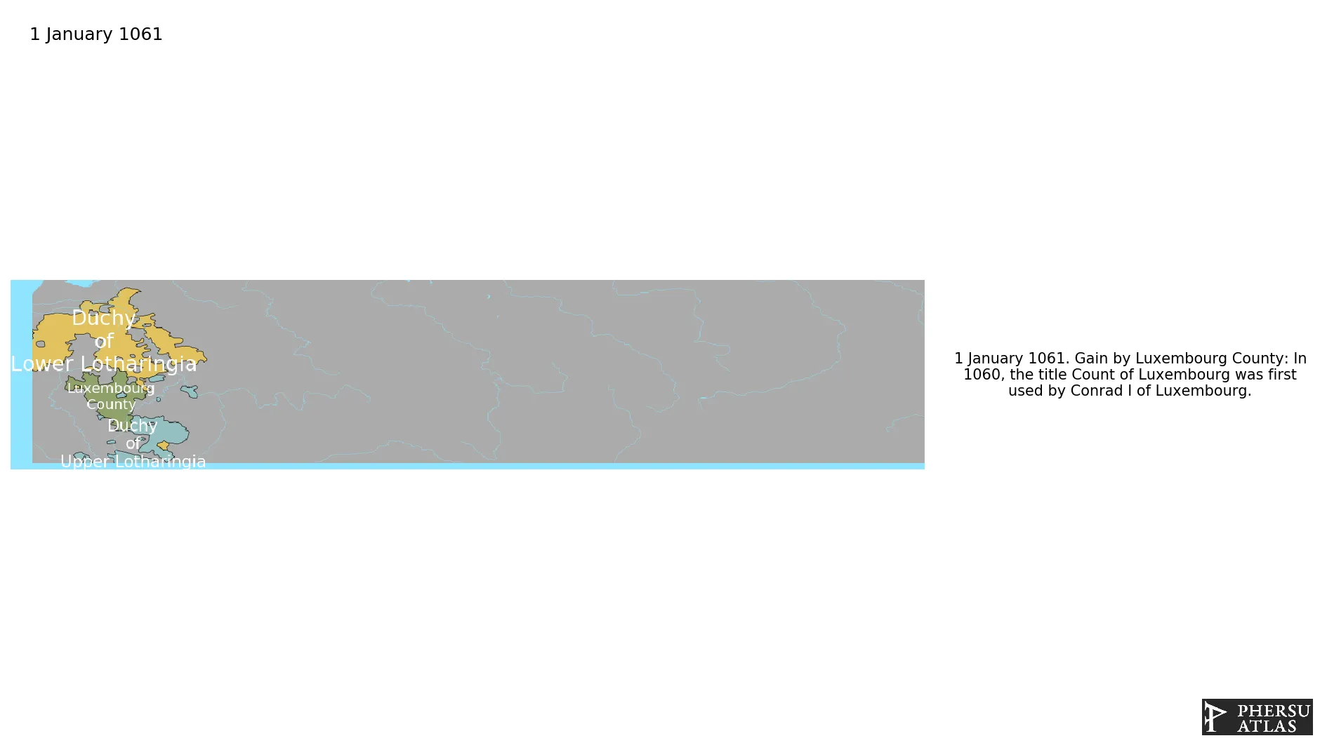
Was the domain of the Luxembourg House in the Holy Roman Empire. Its core territory was modern-day Luxembourg, but in the coures of the centuries it controlled a series of different territories like Bohemia. For this reason, despites being first a county and then a duchy, it was de facto a composite state. It ceased to exist as an independent state after being annexed to the Burgundian Netherlands.
1. Genealogy
2. Maps of Political Control Over Time
 Luxembourg County : Map showing the initial year each territory was ruled by the polity
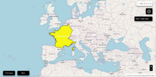
Luxembourg County : Map depicting the polity's ruler in power when each territory was first controlled
Luxembourg County : Maximal Extension of the Polity
Luxembourg County : Map showing the initial year each territory was ruled by the polity
Luxembourg County : Map depicting the polity's ruler in power when each territory was first controlled
Luxembourg County : Maximal Extension of the Polity
3. Monthly Summaries

4. Lists and Timelines
 Luxembourg County : List of events the polity was involved in
Luxembourg County : List of Rulers
Luxembourg County : Timeline of Rulers
Luxembourg County : List of events the polity was involved in
Luxembourg County : List of Rulers
Luxembourg County : Timeline of Rulers
5. Rankings
 Luxembourg County : Top rulers ordered by largest reached area
Luxembourg County : Top wars ordered by largest reached area
Luxembourg County : Top rulers by territorial gain or loss in terms of area difference
Luxembourg County : Top wars by territorial gain or loss in terms of area of the changes
Luxembourg County : Top wars by territorial gain or loss in terms of area difference
Luxembourg County : Top rulers ordered by largest reached area
Luxembourg County : Top wars ordered by largest reached area
Luxembourg County : Top rulers by territorial gain or loss in terms of area difference
Luxembourg County : Top wars by territorial gain or loss in terms of area of the changes
Luxembourg County : Top wars by territorial gain or loss in terms of area difference
6. Time Series
Luxembourg County : Time Series of all Territorial Changes
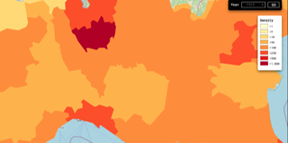
Luxembourg County : time series of its population and area throughout history
7. All Events mentioned in Territorial Changes

8. All Cities mentioned in Territorial Changes
 Kalisz
Wieluń
Częstochowa
Łódź
Radomsko
Kraków
Opoczno
Stary Sącz
Kielce
Wiślica
Tarnów
Radom
Sandomierz
Rzeszów
Lublin
Przemyśl
Kalisz
Wieluń
Częstochowa
Łódź
Radomsko
Kraków
Opoczno
Stary Sącz
Kielce
Wiślica
Tarnów
Radom
Sandomierz
Rzeszów
Lublin
Przemyśl
Prüm
Liège
Ciney
Ciney
Liège
Glatz
Crossen an der Oder
Sagan
Zielona Góra
Glogau
Liegnitz
Jauer
Wahlstatt
Schweidnitz
Leubus
Guhrau
Breslau
Münsterberg
Trebnitz
Militsch
Oels
Brieg
Oppeln
Cosel
Ratibor
Strehlitz
Teschen
Gliwice
Beuthen
Katowice
Kraków
Hoyerswerda
Budissin
Görlitz
Crossen an der Oder
Sagan
Zielona Góra
Glogau
Liegnitz
Jauer
Wahlstatt
Schweidnitz
Leubus
Guhrau
Glatz
Breslau
Münsterberg
Trebnitz
Militsch
Oels
Brieg
Oppeln
Cosel
Ratibor
Strehlitz
Teschen
Gliwice
Beuthen
Katowice
Prüm
Kraków
Kraków
Hoyerswerda
Budissin
Görlitz
Kalisz
Wieluń
Częstochowa
Łódź
Radomsko
Kraków
Opoczno
Stary Sącz
Kielce
Wiślica
Tarnów
Radom
Sandomierz
Rzeszów
Lublin
Przemyśl
Kalisz
Wieluń
Częstochowa
Łódź
Radomsko
Kraków
Opoczno
Stary Sącz
Kielce
Wiślica
Tarnów
Radom
Sandomierz
Rzeszów
Lublin
Przemyśl
Prüm
Liège
Ciney
Ciney
Liège
Glatz
Crossen an der Oder
Sagan
Zielona Góra
Glogau
Liegnitz
Jauer
Wahlstatt
Schweidnitz
Leubus
Guhrau
Breslau
Münsterberg
Trebnitz
Militsch
Oels
Brieg
Oppeln
Cosel
Ratibor
Strehlitz
Teschen
Gliwice
Beuthen
Katowice
Kraków
Hoyerswerda
Budissin
Görlitz
Crossen an der Oder
Sagan
Zielona Góra
Glogau
Liegnitz
Jauer
Wahlstatt
Schweidnitz
Leubus
Guhrau
Glatz
Breslau
Münsterberg
Trebnitz
Militsch
Oels
Brieg
Oppeln
Cosel
Ratibor
Strehlitz
Teschen
Gliwice
Beuthen
Katowice
Prüm
Kraków
Kraków
Hoyerswerda
Budissin
Görlitz