 Mauritius (Great Britain): All Data
This page is about the data available for this polity; the chronology of its events is available here.
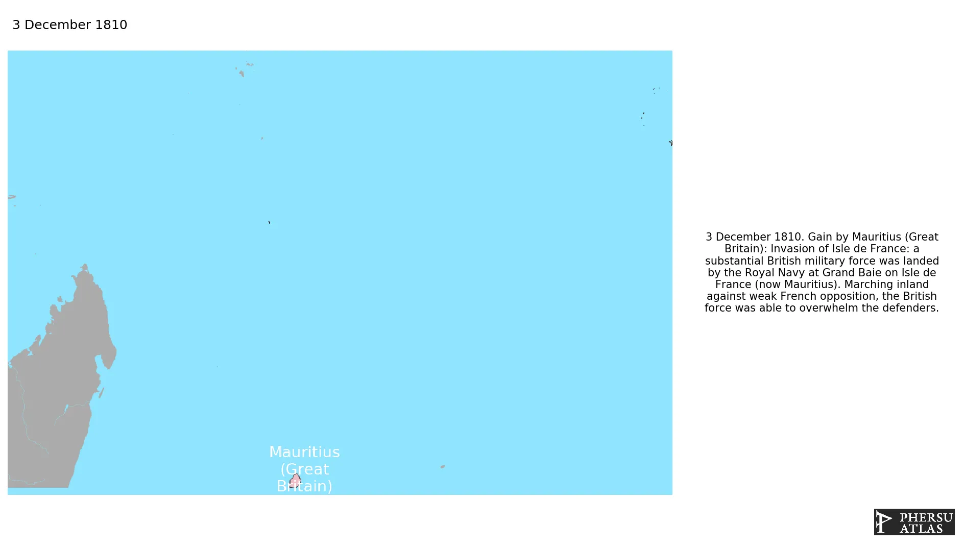
Mauritius Is an island in the Indian Ocean. The British conquered the island in 1810, during the Napoleonic Wars.
1. Genealogy

2. Maps of Political Control Over Time
 Mauritius (Great Britain) : Map showing the initial year each territory was ruled by the polity
Mauritius (Great Britain) : Maximal Extension of the Polity
Mauritius (Great Britain) : Map showing the initial year each territory was ruled by the polity
Mauritius (Great Britain) : Maximal Extension of the Polity
3. Monthly Summaries

4. Lists and Timelines
5. Rankings
 Mauritius (Great Britain) : Top wars ordered by largest reached area
Mauritius (Great Britain) : Top wars by territorial gain or loss in terms of area of the changes
Mauritius (Great Britain) : Top wars by territorial gain or loss in terms of area difference
Mauritius (Great Britain) : Top wars ordered by largest reached area
Mauritius (Great Britain) : Top wars by territorial gain or loss in terms of area of the changes
Mauritius (Great Britain) : Top wars by territorial gain or loss in terms of area difference
6. Time Series
Mauritius (Great Britain) : Time Series of all Territorial Changes
Mauritius (Great Britain) : time series of its population and area throughout history

