 Republic of the Union of Myanmar: All Data
This page is about the data available for this polity; the chronology of its events is available here.
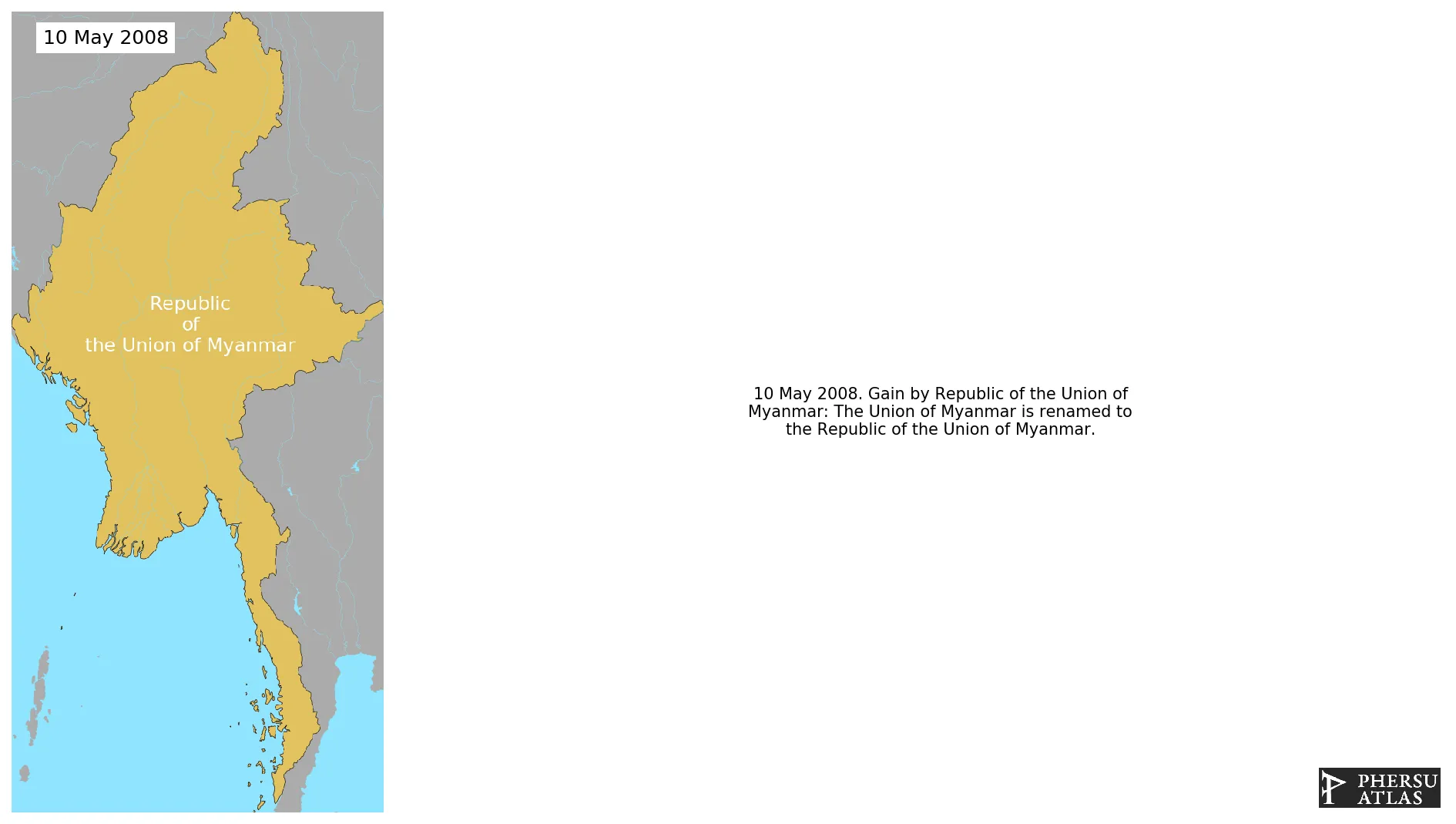
Is a country in Southeast Asia. It is bordered by Bangladesh and India to its northwest, China to its northeast, Laos and Thailand to its east and southeast. The country gained independence fomr the United Kingdom in 1948. The actual denomination was introduced in 2008.
1. Genealogy

2. Maps of Political Control Over Time
 Republic of the Union of Myanmar : Map showing the initial year each territory was ruled by the polity
Republic of the Union of Myanmar : Maximal Extension of the Polity
Republic of the Union of Myanmar : Map showing the initial year each territory was ruled by the polity
Republic of the Union of Myanmar : Maximal Extension of the Polity
3. Administrative Divisions
4. Monthly Summaries

5. Lists and Timelines
6. Rankings
 Republic of the Union of Myanmar : Top wars ordered by largest reached area
Republic of the Union of Myanmar : Top wars by territorial gain or loss in terms of area of the changes
Republic of the Union of Myanmar : Top wars by territorial gain or loss in terms of area difference
Republic of the Union of Myanmar : Top wars ordered by largest reached area
Republic of the Union of Myanmar : Top wars by territorial gain or loss in terms of area of the changes
Republic of the Union of Myanmar : Top wars by territorial gain or loss in terms of area difference
7. Time Series
Republic of the Union of Myanmar : Time Series of all Territorial Changes
Republic of the Union of Myanmar : time series of its population and area throughout history

