 Peru-Bolivian Confederation: All Data
This page is about the data available for this polity; the chronology of its events is available here.
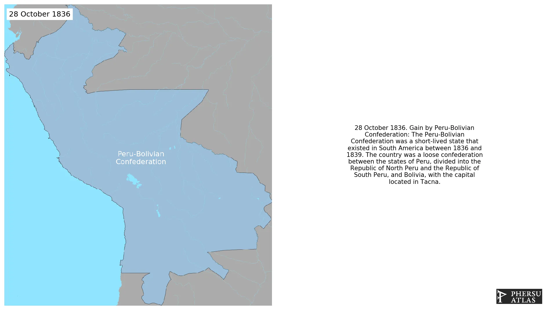
The Peru-Bolivian Confederation was a short-lived state that existed in South America between 1836 and 1839. The country was a loose confederation between the states of Peru, divided into the Republic of North Peru and the Republic of South Peru, and Bolivia, with the capital located in Tacna.
1. Genealogy
2. Maps of Political Control Over Time
 Peru-Bolivian Confederation : Map showing the initial year each territory was ruled by the polity
Peru-Bolivian Confederation : Map depicting the polity's ruler in power when each territory was first controlled
Peru-Bolivian Confederation : Maximal Extension of the Polity
Peru-Bolivian Confederation : Map showing the initial year each territory was ruled by the polity
Peru-Bolivian Confederation : Map depicting the polity's ruler in power when each territory was first controlled
Peru-Bolivian Confederation : Maximal Extension of the Polity
3. Monthly Summaries

4. Lists and Timelines
 Peru-Bolivian Confederation : List of events the polity was involved in
Peru-Bolivian Confederation : List of Rulers
Peru-Bolivian Confederation : Timeline of Rulers
Peru-Bolivian Confederation : List of events the polity was involved in
Peru-Bolivian Confederation : List of Rulers
Peru-Bolivian Confederation : Timeline of Rulers
5. Rankings
 Peru-Bolivian Confederation : Top rulers ordered by largest reached area
Peru-Bolivian Confederation : Top wars ordered by largest reached area
Peru-Bolivian Confederation : Top rulers by territorial gain or loss in terms of area difference
Peru-Bolivian Confederation : Top wars by territorial gain or loss in terms of area of the changes
Peru-Bolivian Confederation : Top wars by territorial gain or loss in terms of area difference
Peru-Bolivian Confederation : Top rulers ordered by largest reached area
Peru-Bolivian Confederation : Top wars ordered by largest reached area
Peru-Bolivian Confederation : Top rulers by territorial gain or loss in terms of area difference
Peru-Bolivian Confederation : Top wars by territorial gain or loss in terms of area of the changes
Peru-Bolivian Confederation : Top wars by territorial gain or loss in terms of area difference
6. Time Series
Peru-Bolivian Confederation : Time Series of all Territorial Changes
Peru-Bolivian Confederation : time series of its population and area throughout history
7. All Events mentioned in Territorial Changes
 Salaverry-Santa Cruz War
War between the Argentine and Peru-Bolivian confederations
War of the Confederation
Dissolution of the Peru-Bolivian Confederation
Salaverry-Santa Cruz War
War between the Argentine and Peru-Bolivian confederations
War of the Confederation
Dissolution of the Peru-Bolivian Confederation
