Most recent flag or coat of arms
Maximum Extent
Maximum Extent (Interactive Map)

Data

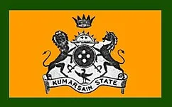
Name: kumarsain state

Type: Cluster

Start: 1051 AD

End: 1947 AD

Statistics

All Statistics: All Statistics

Icon kumarsain state

If you are looking for the page with the statistics about this nation you can find it here: All Statistics

The cluster includes all the forms of the country.

The cluster includes the following incarnations of the same nation:

  • Kumarsain State
  • Kumarsain State (Princely State)
  • Establishment


  • January 1051: Kirat Singh, also known as Kirti Singh (later Rana Kirat Chand), who was an office holder and Jagirdar at the court of Raja Narayan Pal of Gaya in Bihar, founded Kumharsain State in the 11th century AD.
  • Chronology


    Interactive Chronologies with maps are available in the section Changes Navigation

    1. Partition of India


    Was the partition of British India in two independent entities: India (with a Hindu majority) and Pakistan (with a Muslim majority). This included the several princely states that were dependent on the British Colony.

  • January 1948: Accession to India (exact date not known). The Indian Independence Act came into being on 15 August.

  • 2. Further events (Unrelated to Any War)


  • January 1451: Since the 15th century, Kumharsain was a feudatory of Bushahr State.

  • January 1816: Kumharsain State was ranked 6th in Order of precedence in the Shimla Hill States and 11th amongst the Punjab Hill States.

  • Disestablishment


  • January 1948: Accession to India (exact date not known). The Indian Independence Act came into being on 15 August.
  • Selected Sources


  • Indian independence Act. Retrieved on March, 24th 2024 on https://www.legislation.gov.uk/ukpga/1947/30/pdfs/ukpga_19470030_en.pdf
  • All Phersu Atlas Regions

    Africa

    Americas

    Asia

    Europe

    Oceania