
Data
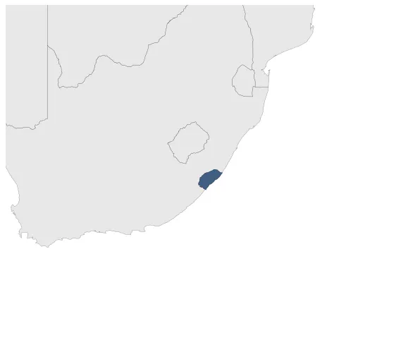
Name: AmaPondo
Type: Polity
Start: 1816 AD
End: 1894 AD
Statistics
All Statistics: All Statistics
 AmaPondo
If you are looking for the page with the statistics about this polity you can find it here:All Statistics
Was a precolonial indigenous chiefdom or kingdom of the Mpondo people in modern-day South Africa. It is unclear whether the Pondoland (amaPondo) depicted on maps was a separate country from amaPondomise, or the two were one unique continuum. For this reason amaPondo and amaPondomise are depicted as two separate polities,.
Summary
Mpondo (Pondo) NGUNI people who have inhabited
the area between the Mtata and Mtamvuna rivers in present-
day SOUTH AFRICA for nearly two centuries. The
Mpondo were forced to flee their homelands during the
MFECANE, a series of ZULU military campaigns begun in
the 1820s. Chief Faku reorganized the Mpondo and established
an agricultural state west of the Mzinvubu River
between present-day Durban and Port Edward.
Good trade relations with the Europeans coupled
with increased agricultural productivity created a seemingly
stable Mpondo nation. However, internal conflict
among rival clans made the Mpondo vulnerable to European
conquest. Mpondo territories, coveted for their
agricultural richness as well as for grazing lands, were
overtaken by the British and incorporated into CAPE
COLONY in 1894.
Establishment
Chronology
Interactive Chronologies with maps are available in the section Changes Navigation


