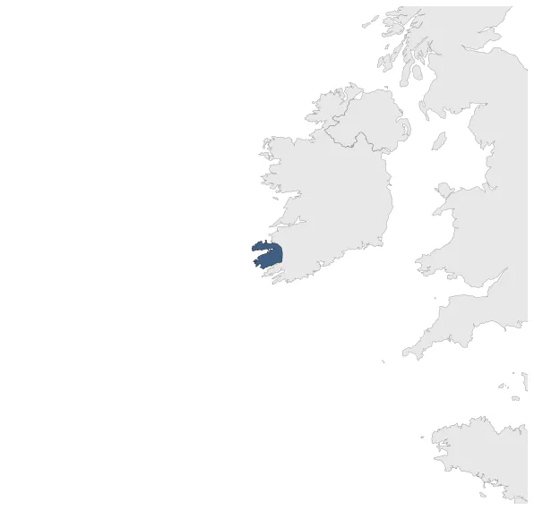
Maximum Extent
Maximum Extent (Interactive Map)

Data

Name: Corcu Duibne

Type: Polity

Start: 501 AD

End: 1000 AD

Statistics

All Statistics: All Statistics

Icon Corcu Duibne

If you are looking for the page with the statistics about this polity you can find it here:All Statistics

Was a kingdom of Gaelic Ireland which included the Dingle Peninsula, the Iveragh Peninsula and connecting lands.

Establishment


  • January 501: Corcu Duibne was a notable kingdom in prehistoric and medieval County Kerry, Ireland, which included the Dingle Peninsula, the Iveragh Peninsula and connecting lands. The existence of the Corcu Duibne is attested as early as the 5th century.
  • Chronology


    Interactive Chronologies with maps are available in the section Changes Navigation

    Disestablishment


  • January 1001: The Corcu Duibne kingdom is absorbed by Mumu after the first millennium.
  • All Phersu Atlas Regions

    Africa

    Americas

    Asia

    Europe

    Oceania