Izalla
If you are looking for the page with the statistics about this polity you can find it here:All Statistics
An Aramaic state of unknown exact location that existed around 1000 BC.
Establishment
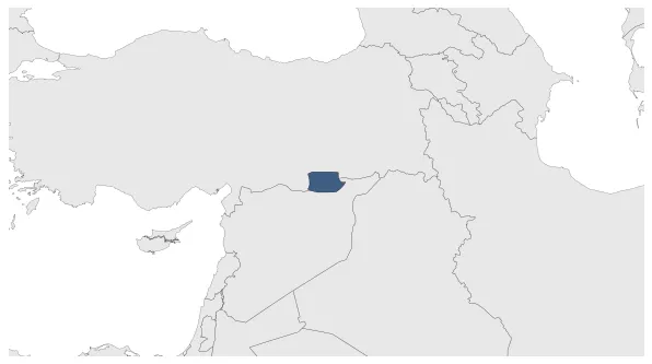
January 999 BC: Izalla was an Aramaic state of unknown exact location.
January 999 BC: Izalla was an Aramaic state of unknown exact location. Many historians consider that it was in the western part of the Tur Abdin, but others place it towards the Tektek Dagh, a mountain east of Urfa, and the plain between these mountains and Mount Kashiari. The state existed from around 1000 BC.
Chronology
Interactive Chronologies with maps are available in the section Changes Navigation
Military Campaigns of Assyrian King Adad-nirari II.
January 890 BC: Assyrian king Adadnirari II subjugated the areas to the north of Assyria previously under only nominal Assyrian vassalage, conquering and deporting Aramean and Hurrian.
January 890 BC: Izalla was subject to tribute by Assyrian king Adadnirari II.
Disestablishment
January 890 BC: Assyrian king Adadnirari II subjugated the areas to the north of Assyria previously under only nominal Assyrian vassalage, conquering and deporting Aramean and Hurrian.
January 890 BC: Izalla was subject to tribute by Assyrian king Adadnirari II.