Maximum Extent
Maximum Extent (Interactive Map)

Data

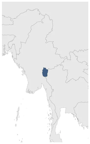
Name: Karenni States

Type: Polity

Start: 1801 AD

End: 1892 AD

Statistics

All Statistics: All Statistics

Icon Karenni States

If you are looking for the page with the statistics about this polity you can find it here:All Statistics

Was the name given to the states inhabited mainly by the Red Karen, in the area of present-day Kayah State, eastern Burma.

Establishment


  • January 1801: The Karenni States were states inhabited mainly by the Red Karen, in the area of present-day Kayah State, eastern Burma. There are no historical data on the Karenni States before the 19th century.
  • Chronology


    Interactive Chronologies with maps are available in the section Changes Navigation

    Disestablishment


  • January 1893: The Karenni States were recognized as tributary to British Burma in 1892, when their rulers agreed to accept a stipend from the British government.
  • All Phersu Atlas Regions

    Africa

    Americas

    Asia

    Europe

    Oceania