Most recent flag or coat of arms
Maximum Extent
Maximum Extent (Interactive Map)

Data

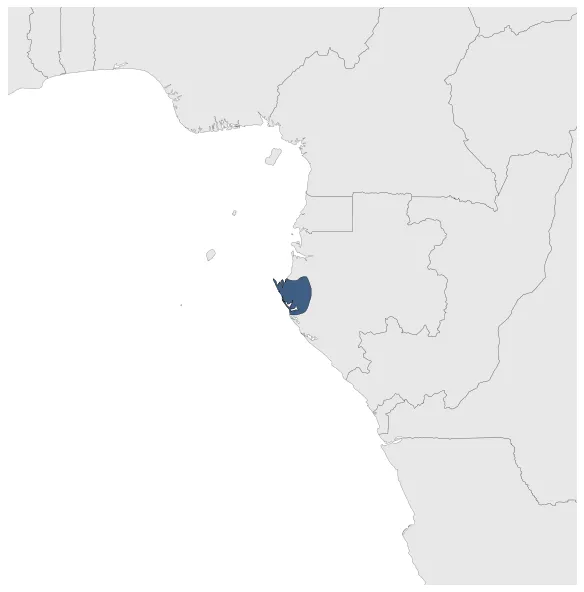
Name: Kingdom of Orungu

Type: Polity

Start: 1701 AD

End: 1873 AD

Statistics

All Statistics: All Statistics

Icon Kingdom of Orungu

If you are looking for the page with the statistics about this polity you can find it here:All Statistics

The Orungu Kingdom (c. 1700-1927), was a small pre-colonial state located in the west of present-day Gabon, in the estuary of the Ogooue.

Establishment


  • January 1701: The Orungu kingdom was a small pre-colonial state located in the west of present-day Gabon, in the Ogooué estuary.
  • Chronology


    Interactive Chronologies with maps are available in the section Changes Navigation

    Disestablishment


  • January 1874: The fall of the Orungu Kingdom was directly tied to the fall of the slave trade. The king had become dependent on it and was unable to maintain the custom of royal patronage without it. This caused the kingdom to disintegrate and in 1873, King Ntchengué signed a treaty granting the French a post on Orungu territory.
  • All Phersu Atlas Regions

    Africa

    Americas

    Asia

    Europe

    Oceania