Video Summary
Video Summary
Maximum Extent
Maximum Extent (Interactive Map)

Data

Name: Mongyang

Type: Polity

Start: 1401 AD

End: 1604 AD

Statistics

All Statistics: All Statistics

Icon Mongyang

If you are looking for the page with the statistics about this polity you can find it here:All Statistics

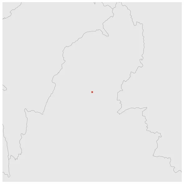
Was an outlying territory, located away from the main Shan State area in present-day Kachin State. The main town was Mohnyin (Mong Yang).

Establishment


  • January 1401: The state of Mongyang existed before 1400 AD.
  • Chronology


    Interactive Chronologies with maps are available in the section Changes Navigation

    1. Forty Years´ War


    Was a military war fought between the Burmese-speaking Kingdom of Ava and the Mon-speaking Kingdom of Hanthawaddy.

  • January 1407: Ava expanded greatly between 1404 and 1406: it absorbed the Shan states of Kale and Mohnyin in the north, and Arakan in the west.

  • 2. Further events (Unrelated to Any War)


  • January 1572: In 1571, the remote hill states of Mohnyin and Mogaung, located in present-day Myanmar, revolted against the ruling authority. The territory of Mohnyin was eventually annexed by Mongyang, a neighboring region.

  • January 1577: In 1576, the Kingdom of Toungoo gained control over Mohnyin, following Pegu's reestablishment of control over Lan Xang in 1575. This period marked a time of shifting power dynamics in Southeast Asia.

  • January 1585: Mongyang occupied by the Taungoo Dynasty of Burma between 1579 and 1584.

  • Disestablishment


  • January 1605: Mongyang annexed by the Kingdom of Burma.
  • All Phersu Atlas Regions

    Africa

    Americas

    Asia

    Europe

    Oceania