Maximum Extent
Maximum Extent (Interactive Map)

Data

Name: Maluka State

Type: Polity

Start: 1812 AD

End: 1816 AD

Statistics

All Statistics: All Statistics

Icon Maluka State

If you are looking for the page with the statistics about this polity you can find it here:All Statistics

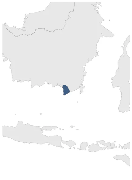
Was a small independent state located around the Sungei Maluka, southeast of Bandjermassin on the island of Borneo. It was established in a land concession acquired by English adventurer Alexander Hare.

Establishment


  • January 1812: In 1811, during the Napoleonic wars, the British took over Sungei Maluka and established a presence there. Alexander Hare, a British colonial administrator, then established the independent state of Maluka in the region.
  • Chronology


    Interactive Chronologies with maps are available in the section Changes Navigation

    1. Events


  • January 1813: The state of Maluka is established on the island of Borneo, in a land concession acquired by English adventurer Alexander Hare from the sultan of Banjarmassin.

  • Disestablishment


  • January 1817: The Maluka State ceased to exist when the Dutch returned in 1816 in Indonesia.
  • All Phersu Atlas Regions

    Africa

    Americas

    Asia

    Europe

    Oceania