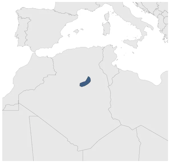
Maximum Extent
Maximum Extent (Interactive Map)

Data

Name: Ouargla

Type: Polity

Start: 1301 AD

End: 1577 AD

Statistics

All Statistics: All Statistics

Icon Ouargla

If you are looking for the page with the statistics about this polity you can find it here:All Statistics

Was a kingdom located in the desert of Algeria and centered on the city of Ouargla.

Establishment


  • January 1301: Sedrata was then destroyed in the 13th century, marking the end of the prosperity known in the 10th and 11th centuries. Ouargla then definitely becomes the main center of the region.
  • Chronology


    Interactive Chronologies with maps are available in the section Changes Navigation

    1. Conquests of Murad III


    Expansion during the rule of Murad III in the Ottoman Empire.

  • January 1578: In 1577, the territory of Ouargla was taken over by the Ottoman Empire. Previously, in the 16th century, the Beylerbey of Algiers Salah Raïs had paid tribute to the populations of Ouargla before it became part of the Eastern Beylik.

  • Disestablishment


  • January 1578: In 1577, the territory of Ouargla was taken over by the Ottoman Empire. Previously, in the 16th century, the Beylerbey of Algiers Salah Raïs had paid tribute to the populations of Ouargla before it became part of the Eastern Beylik.
  • All Phersu Atlas Regions

    Africa

    Americas

    Asia

    Europe

    Oceania