Maximum Extent
Maximum Extent (Interactive Map)

Data

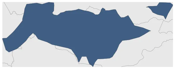
Name: Xueyantuo Khanate

Type: Polity

Start: 631 AD

End: 648 AD

Statistics

All Statistics: All Statistics

Icon Xueyantuo Khanate

If you are looking for the page with the statistics about this polity you can find it here:All Statistics

Was the Khanate of the Xueyantuo tribe that emerged from the Eastern Turkic Khaganate after the latter was destroyed by a Chinese military offensive in 629 AD. It was located in northeast Asia.

Establishment


  • January 631: The Xueyantuo Khanate launched the offensive in winter 629, with the major general Li Jing in command, and in 630, after Li Jing captured Ashina Duobi, the Eastern Turkic Khaganate was destroyed. Subsequently, control of the territory north of Tang (check mate ak.w.m) largely fell to Xueyantuo.
  • January 631: In 630, central and northern Mongolia came under the control of the Toquz Oghuz tribe.
  • Chronology


    Interactive Chronologies with maps are available in the section Changes Navigation

    1. Tang campaign against the Eastern Turks


    Was an offensive in winter 629 of the Tang Dynasty, under the command of general Li Jing that led to the destruction of the Eastern Turkic Khaganate.


    2. Campaigns of Tai Zong


    Military campaigns of Chinese Tang emperor Tai Zong.

  • January 647: In 647, the Tang Dynasty expanded its territory by annexing the Anbei Protectorate, which was previously under the rule of the Xuyantuo Khanate. This conquest was part of the Tang Dynasty's efforts to consolidate its power and control over the region.
  • September 648: The Xueyantuo Khanate was destroyed by the Tang.

  • Disestablishment


  • September 648: The Xueyantuo Khanate was destroyed by the Tang.
  • All Phersu Atlas Regions

    Africa

    Americas

    Asia

    Europe

    Oceania