Most recent flag or coat of arms of British East India Company (Military Occupation)
Most recent flag or coat of arms

Information

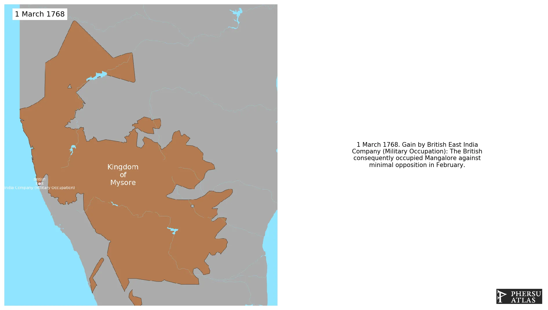
Name: British East India Company (Military Occupation)

Type: Polity

Start: 1768

End: 1799

polity British East India Company (Military Occupation): All Data

This page is about the data available for this polity, the chronology of the events of the polity is available here.

Polity that includes all territories militarly occupied by British East India Company that are not part of a specific military territory.

1. Maps of Political Control Over Time

2. Maximum Historical Extents during Events

3. Lists and Timelines of Events that took place in the Polity

4. Maps Comparing Territorial Boundaries Before and After Wars

map_chartConquests of Shahu II

map_chartThird Anglo-Mysore War

map_chartAllied advances

map_chartPartition of Mysore

map_chartAnglo-Indian Wars

map_chartAnglo-Mysore Wars

map_chartThird Anglo-Mysore War

map_chartAllied advances

map_chartFourth Anglo-Mysore War

map_chartPartition of Mysore

5. Monthly Summaries of Events

Monthly Summaries of Events during Wars

6. Time Series of Territorial Changes

Time Series of Territorial Changes by specific invasor/invaded couple

Time Series of Territorial Changes during specific Events

7. Time Series of Historical Population and Area

Historical Population and Area during specific Events

8. Events Navigation - Explore All Territorial Changes

All Territorial Changes during specific Events

9. Cities mentioned in territorial changes

All Phersu Atlas Regions

Africa

Americas

Asia

Europe

Oceania