Most recent flag or coat of arms of Samtskhe-Saatabago (Ottoman Empire)
Most recent flag or coat of arms

Information

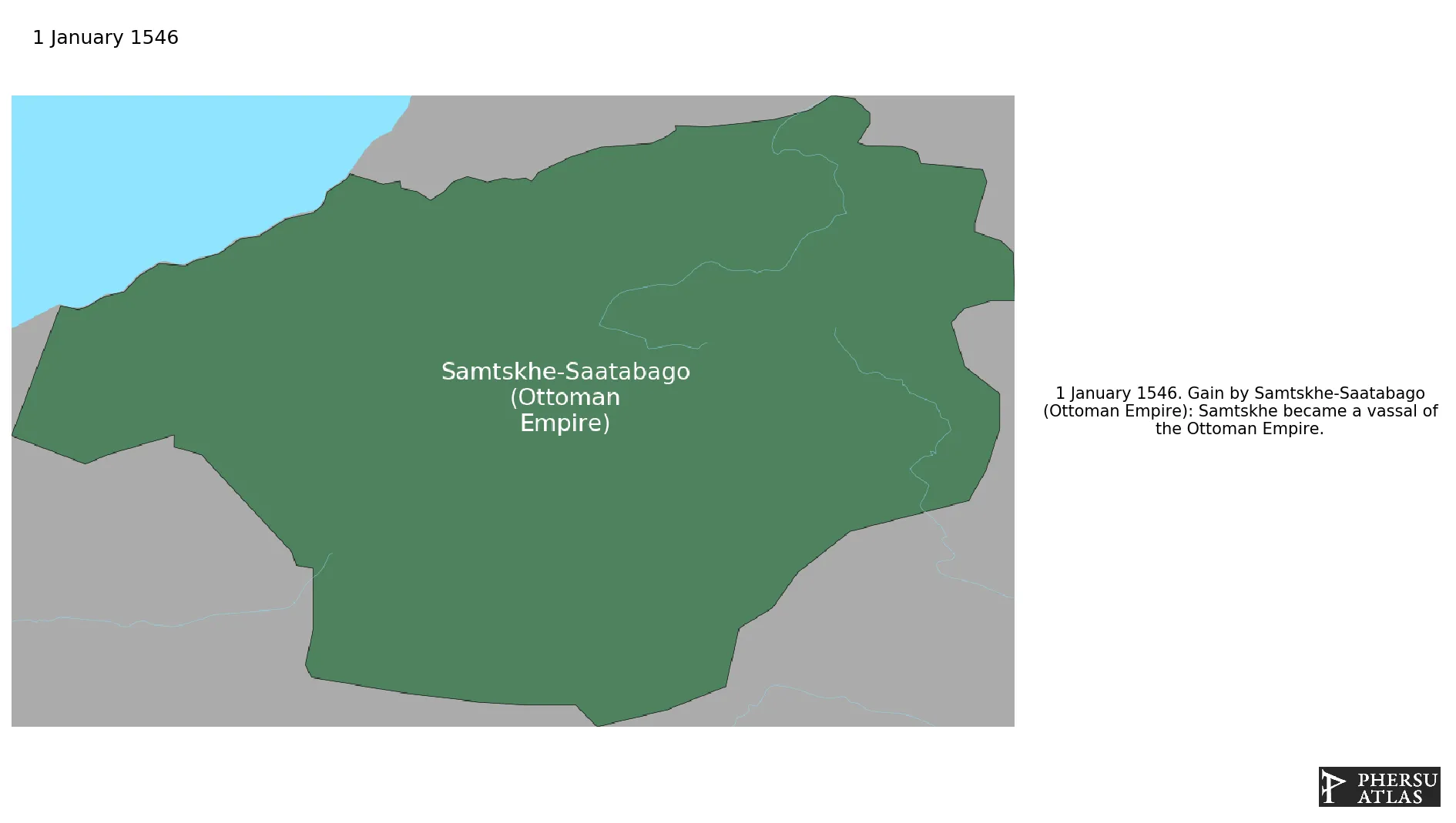
Name: Samtskhe-Saatabago (Ottoman Empire)

Type: Polity

Nation: samtskhe-saatabago

Start: 1546

End: 1628

polity Samtskhe-Saatabago (Ottoman Empire): All Data

This page is about the data available for this polity, the chronology of the events of the polity is available here.

Was a Georgian feudal principality. Its territory consisted of the modern-day Samtskhe-Javakheti region and the historical region of Tao-Klarjeti. As a result of a dispute with the royal Georgian court, the province of Samtskhe seceded. In 1545 Samtskhe became vassal of the Ottoman Empire.

1. Maps of Political Control Over Time

2. Maximum Historical Extents during Events

3. Lists and Timelines of Rulers

4. Lists and Timelines of Events that took place in the Polity

5. Maps Comparing Territorial Boundaries Before and After Wars

6. Monthly Summaries of Events

Monthly Summaries of Events during Wars

7. Time Series of Territorial Changes

Time Series of Territorial Changes by specific invasor/invaded couple

Time Series of Territorial Changes during specific Events

8. Time Series of Historical Population and Area

Historical Population and Area during specific Events

9. Events Navigation - Explore All Territorial Changes

All Territorial Changes during specific Events

10. Rulers (only those who where involved in territorial changes)

11. Cities mentioned in territorial changes

All Phersu Atlas Regions

Africa

Americas

Asia

Europe

Oceania