Most recent flag or coat of arms of Pappenheim County
Most recent flag or coat of arms

Information

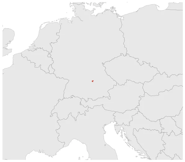
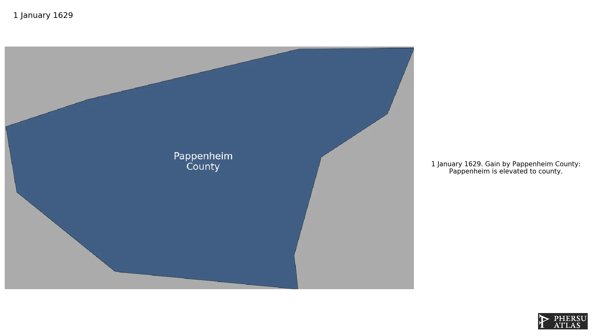
Name: Pappenheim County

Type: Polity

Nation: pappenheim

Start: 1629

End: 1806

Groups:

Holy Roman Empire

polity Pappenheim County: All Data

This page is about the data available for this polity, the chronology of the events of the polity is available here.

Was a lordship, and later a county, of the Holy Roman Empire located in western Bavaria.

1. Maps of Political Control Over Time

2. Maximum Historical Extents during Events

3. Lists and Timelines of Events that took place in the Polity

4. Maps Comparing Territorial Boundaries Before and After Wars

map_chartEuropean wars of religion

map_chartThirty Years' War

5. Monthly Summaries of Events

Monthly Summaries of Events during Wars

6. Time Series of Territorial Changes

Time Series of Territorial Changes by specific invasor/invaded couple

Time Series of Territorial Changes during specific Events

7. Time Series of Historical Population and Area

Historical Population and Area during specific Events

8. Events Navigation - Explore All Territorial Changes

All Territorial Changes during specific Events

9. Cities mentioned in territorial changes

All Phersu Atlas Regions

Africa

Americas

Asia

Europe

Oceania