Most recent flag or coat of arms of Nawanagar State (Princely State)
Most recent flag or coat of arms

Information

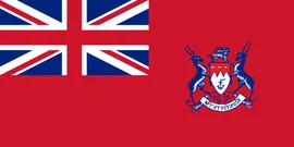
Name: Nawanagar State (Princely State)

Type: Polity

Nation: nawanagar state

Start: 1812

End: 1948

Groups:

Indian Princely States

polity Nawanagar State (Princely State): All Data

This page is about the data available for this polity, the chronology of the events of the polity is available here.

Was an Indian princely state in the historical Halar region, located on the southern shores of the Gulf of Kutch. It was ruled by the Jadeja Rajput dynasty.

1. Maps of Political Control Over Time

2. Lists and Timelines of Rulers

3. Lists and Timelines of Events that took place in the Polity

4. Maps Comparing Territorial Boundaries Before and After Wars

5. Monthly Summaries of Events

Monthly Summaries of Events during Wars

6. Time Series of Territorial Changes

Time Series of Territorial Changes by specific invasor/invaded couple

Time Series of Territorial Changes during specific Events

7. Time Series of Historical Population and Area

Historical Population and Area during specific Events

8. Events Navigation - Explore All Territorial Changes

All Territorial Changes during specific Events

9. Rulers (only those who where involved in territorial changes)

All Phersu Atlas Regions

Africa

Americas

Asia

Europe

Oceania