 Sint Estatius (Colony): All Data
This page is about the data available for this polity; the chronology of its events is available here.
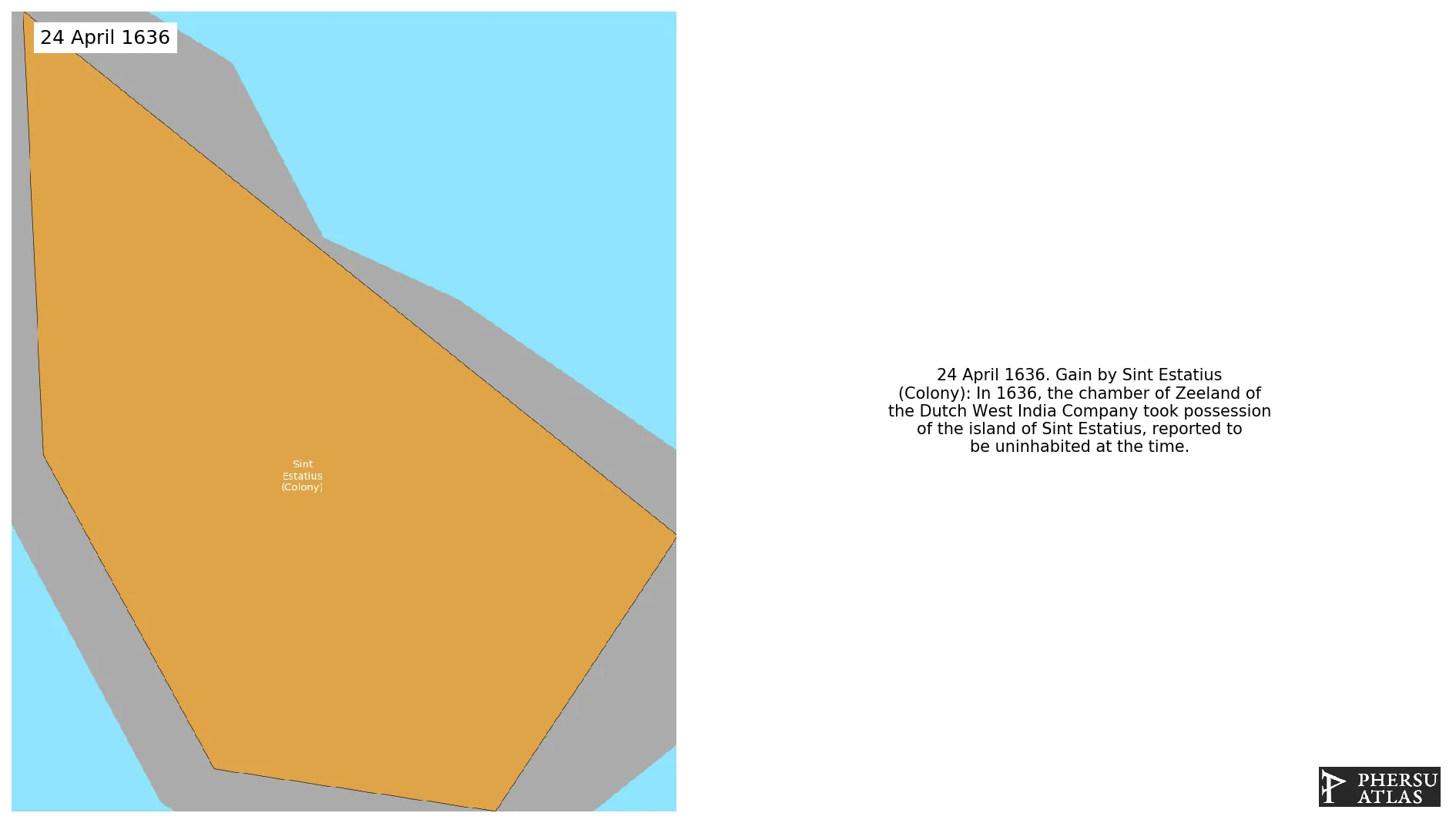
In 1636 the Dutch took possession of the Caribbean island, reported to be uninhabited at the time. In 1954 the island became part of the Netherlands Antilles.
1. Genealogy

2. Maps of Political Control Over Time
 Sint Estatius (Colony) : Map showing the initial year each territory was ruled by the polity
Sint Estatius (Colony) : Maximal Extension of the Polity
Sint Estatius (Colony) : Map showing the initial year each territory was ruled by the polity
Sint Estatius (Colony) : Maximal Extension of the Polity
3. Monthly Summaries

4. Lists and Timelines
5. Rankings
 Sint Estatius (Colony) : Top wars ordered by largest reached area
Sint Estatius (Colony) : Top wars by territorial gain or loss in terms of area of the changes
Sint Estatius (Colony) : Top wars by territorial gain or loss in terms of area difference
Sint Estatius (Colony) : Top wars ordered by largest reached area
Sint Estatius (Colony) : Top wars by territorial gain or loss in terms of area of the changes
Sint Estatius (Colony) : Top wars by territorial gain or loss in terms of area difference
6. Time Series
Sint Estatius (Colony) : Time Series of all Territorial Changes
Sint Estatius (Colony) : time series of its population and area throughout history
