 Territory of the Military Commander in Serbia: All Data
This page is about the data available for this polity; the chronology of its events is available here.
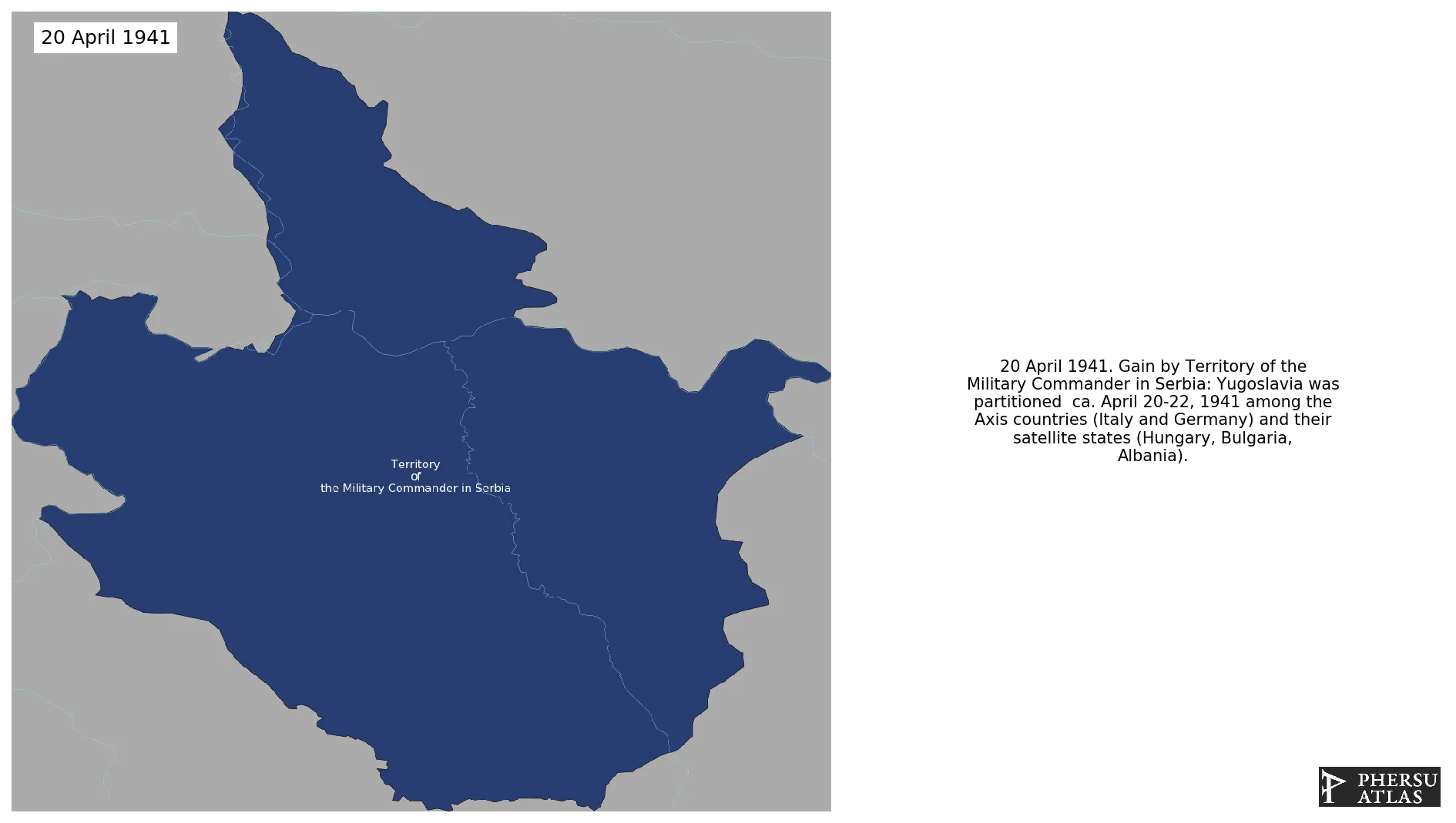
Was the area of the Kingdom of Yugoslavia that was placed under a military government of occupation by the Wehrmacht following the invasion, occupation and dismantling of Yugoslavia in April 1941.
1. Genealogy

2. Maps of Political Control Over Time
 Territory of the Military Commander in Serbia : Map showing the initial year each territory was ruled by the polity
Territory of the Military Commander in Serbia : Maximal Extension of the Polity
Territory of the Military Commander in Serbia : Map showing the initial year each territory was ruled by the polity
Territory of the Military Commander in Serbia : Maximal Extension of the Polity
3. Monthly Summaries

4. Lists and Timelines
5. Rankings
 Territory of the Military Commander in Serbia : Top wars ordered by largest reached area
Territory of the Military Commander in Serbia : Top wars by territorial gain or loss in terms of area of the changes
Territory of the Military Commander in Serbia : Top wars by territorial gain or loss in terms of area difference
Territory of the Military Commander in Serbia : Top wars ordered by largest reached area
Territory of the Military Commander in Serbia : Top wars by territorial gain or loss in terms of area of the changes
Territory of the Military Commander in Serbia : Top wars by territorial gain or loss in terms of area difference
6. Time Series
Territory of the Military Commander in Serbia : Time Series of all Territorial Changes
Territory of the Military Commander in Serbia : time series of its population and area throughout history

