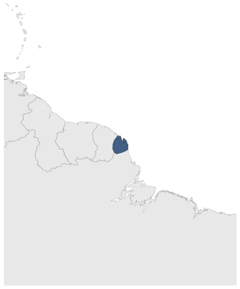
Maximum Extent
Maximum Extent (Interactive Map)

Data

Name: Oyapuc

Type: Polity

Start: 1604 AD

End: 1629 AD

Parent: great britain

Statistics

All Statistics: All Statistics

Icon Oyapuc

If you are looking for the page with the statistics about this polity you can find it here:All Statistics

Oyapoc (or Wiapoco) was a short-lived English settlement in French Guyana on the Oyapock river.

Establishment


  • May 1604: In 1604, the English explorer Captain Charles Leigh attempted to establish the settlement of Oyapoc in French Guiana, at the mouth of the Oyapock river. The territory was later ceded to the French, leading to the abandonment of the English settlement.
  • Chronology


    Interactive Chronologies with maps are available in the section Changes Navigation

    Disestablishment


  • January 1630: By 1629, the British settlement of Oyapuc had faded away.
  • All Phersu Atlas Regions

    Africa

    Americas

    Asia

    Europe

    Oceania