New South Wales
If you are looking for the page with the statistics about this polity you can find it here:All Statistics
Was on of the Colonies founded by the British in Australia and one of the six colonies that federated in 1901 to form the Commonwealth of Australia.
Establishment
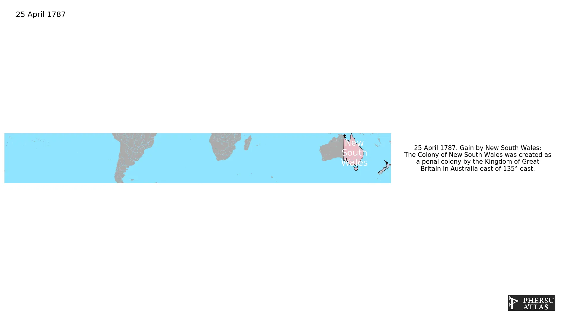
April 1787: The Colony of New South Wales was created as a penal colony by the Kingdom of Great Britain in Australia east of 135° east.
Chronology
Interactive Chronologies with maps are available in the section Changes Navigation
1. Events
March 1788: In January 1788, Governor Arthur Phillip ordered Lieutenant Philip Gidley King to lead a party of 15 convicts and seven free men to take control of Norfolk Island, and prepare for its commercial development. They arrived on 6 March.
November 1791: The name "Chatham Islands" comes from the ship HMS Chatham of the Vancouver Expedition, whose captain William R. Broughton landed on 29 November 1791, claimed possession for Great Britain and named the islands after the First Lord of the Admiralty, John Pitt, 2nd Earl of Chatham.
January 1801: The Antipodes Islands were discovered in 1800 by Captain Henry Waterhouse commanding HMS Reliance.
August 1806: The whaler Ocean discovered the Auckland Islands in 1806, finding them uninhabited. Captain Abraham Bristow named them "Lord Auckland's" on 18 August 1806 in honour of his father's friend William Eden, 1st Baron Auckland.
July 1810: Macquarie Island was discovered by Frederick Hasselborough, who claimed it for the United Kingdom and declared it part of New South Wales.
January 1811: Discoveryof the Campbell Islands
July 1825: New South Wales was extended west to 129° east, so that it would include a trading post set up on Melville Island.
July 1825: The borders of the "islands adjacent in the Pacific Ocean" were moved north to 39°12' south, now including only a small part of New Zealand.
December 1825: The southern islands of New South Wales were made the Colony of Van Diemen's Land.
October 1835: Was a temporary association of Māori tribes in the north of the North Island of New Zealand, founded in 1834.
February 1836: The portion of New South Wales between 132° east and 141° east, and south of 26° south, was made the Province of South Australia.
January 1839: The islands of New Zealand were annexed to New South Wales.
February 1840: Under the Treaty of Waitangi, the United Kingdom annexed the United Tribes of New Zealand.
November 1840: The Colony of New Zealand was chartered and split from New South Wales.
May 1842: The Auckland Islands were part of the Colony of New Zealand under the Letters Patent of April 1842.
January 1843: The Chatham Islands officially became part of the Colony of New Zealand in 1842.
September 1844: Norfolk Island was transferred from New South Wales to Van Diemen's Land.
February 1846: The half of New South Wales north of 26° south was made the Colony of North Australia.
January 1847: The Auckland Islands were excluded from New Zealand by the Act of 1846 which defined the southern boundary of New South Wales at 47° 10' south.
December 1847: Following a change in government in the United Kingdom, North Australia was merged back in to New South Wales.
July 1851: The portion of New South Wales south of the Murray River and a line from the headwaters of the river to Cape Howe was made the Colony of Victoria.
June 1859: The portion of New South Wales north of 29° south, the Dumaresq and Macintyre Rivers, and several mountain ridges, and east of 141° east, was made the Colony of Queensland.
October 1861: The portion of New South Wales west of South Australia was transferred to South Australia by letters patent.
March 1862: The portion of New South Wales north of South Australia and east of 138° east was transferred to Queensland.
July 1863: The region of New South Wales north of South Australia was transferred to South Australia.
January 1864: The Auckland Islands were included by the New Zealand Boundaries Act of 1863, an act of the Imperial Parliament at Westminster which extended the boundaries of the colony once more.
June 1890: Macquarie Island was transferred from New South Wales to Tasmania.
Disestablishment
January 1901: Six colonies of the United Kingdom in Australia formed the Commonwealth of Australia.

.svg.png.webp)