
.png.webp)
Data
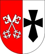
Name: Bremen-Verden (Denmark)
Type: Polity
Start: 1713 AD
End: 1786 AD
Nation: bremen-verden
Parent: denmark
Statistics
All Statistics: All Statistics
 Bremen-Verden (Denmark)
This article is about the specific polity Bremen-Verden (Denmark) and therefore only includes events related to its territory and not to its possessions or colonies. If you are interested in the possession, this is the link to the article about the nation which includes all possessions as well as all the different incarnations of the nation.
If you are looking for the page with the statistics about this polity you can find it here:All Statistics
Was a immediate fief in the Holy Roman Empire. It was occupied by Denmark in 1712 in the course of the Great Northern War (1700-1721) and later sold to Hanover.
Establishment
Chronology
Interactive Chronologies with maps are available in the section Changes Navigation
1. Northern Wars
A series of wars fought in northern and northeastern Europe from the 16th to the 18th century.
Was a conflict in which a coalition led by the Tsardom of Russia successfully contested the supremacy of the Swedish Empire in Northern, Central and Eastern Europe.
1.1.1.Phase 2: Sweden Defending itself
Was the second phase of the Great Northern War. It consisted in the counterattack of all the countries that Sweden had invaded during the first phase of the war.
1.1.1.1.North German Front of the Great Northern War
Was the theatre of war of northern Germany in the second phase of the Great Northern War.


